Flooding the Alps
| Author: | D.Thaler |
|---|---|
| Created: | Nov 2012 |
| Last changed: | 2019-06-27 |
With the help of digital elevation model data one can see what happens if the sea level rises in the area of the European Alps. The goal is not to satisfy apocalyptic fantasies but to illustrate the diminishing blocking effect for vertically extended outbreaks of cold air.
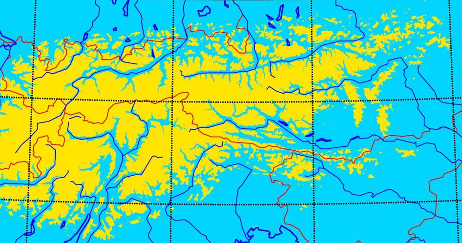
With increasing height the gaps in the mountain barrier become more and more frequent. Lee effects can better be estimated with that special picture in mind. Weather forecasters should be aware of that.
Download videos
All videos can be watched e.g. with a recent version of the open source VLC Media Player.
| Area | Data source | Download |
|---|---|---|
| Alps | GTOPO30 | alps_hd_10fps10m.avi |
| Austria | GTOPO30 | austria_hd_15fps05m.avi |
| Eastern Alps | GTOPO30 | topo_eastalps_hd_slow.avi |
| Austrian Central Alps | SRTM | topo_centralalps_hd_slow.avi |
| Austria - Area Ennstal | SRTM | ennstal_hd_15fps05m.avi |
The average size of the video files is about 20 to 40 Mbyte.
How was it done?
Following DEM-Data has been used:
- 30 arc seconds (~ 1km) DEM GTOPO30 earthexplorer.usgs.gov
- 90m-DEM SRTM DATA VERSION 4.1 srtm.csi.cgiar.org
The core work was done with Python 2.7 with the help of the python modules:
- numpy (calculations)
- matplotlib (plotting)
- matplotlib tool-kit basemap (plotting maps)
- gdal/osgeo (doing GIS-work)
- After having produced quite a lot of Jpg-images AVI-movies were produced with the help of mencoder.
All libraries were used in the versions delivered with Ubuntu Linux 12.04 and 14.04. In most other Linux distributions all necessary programs should be available by their standard repositories.
Program sources
topoflooding.zip
contains the the main python program topoflooding.py and the
config file template configfile_template.py.
Usage:
Make sure you have installed
- python 2.7 (should also work with python 3.x)
- matplotlib 1.1.1 or higher
- basemap 1.02 or higher
- python-gdal 1.7.3 or higher
- mencoder or another movie-maker program
and all their dependencies.
Download topoflooding and configfile_template.py in a separate directory
Make sure you have a DEM-file in a format supported by gdal (compare supported formats in gdal documentation)
edit configfile_template.py concerning to your needs to yourconfigfile.py
Call
python2 topoflooding.py yourconfigfile.pycall mencoder or any other movie-maker tool to make a movie of the image files
Any comments to info at foehnwall dot at